
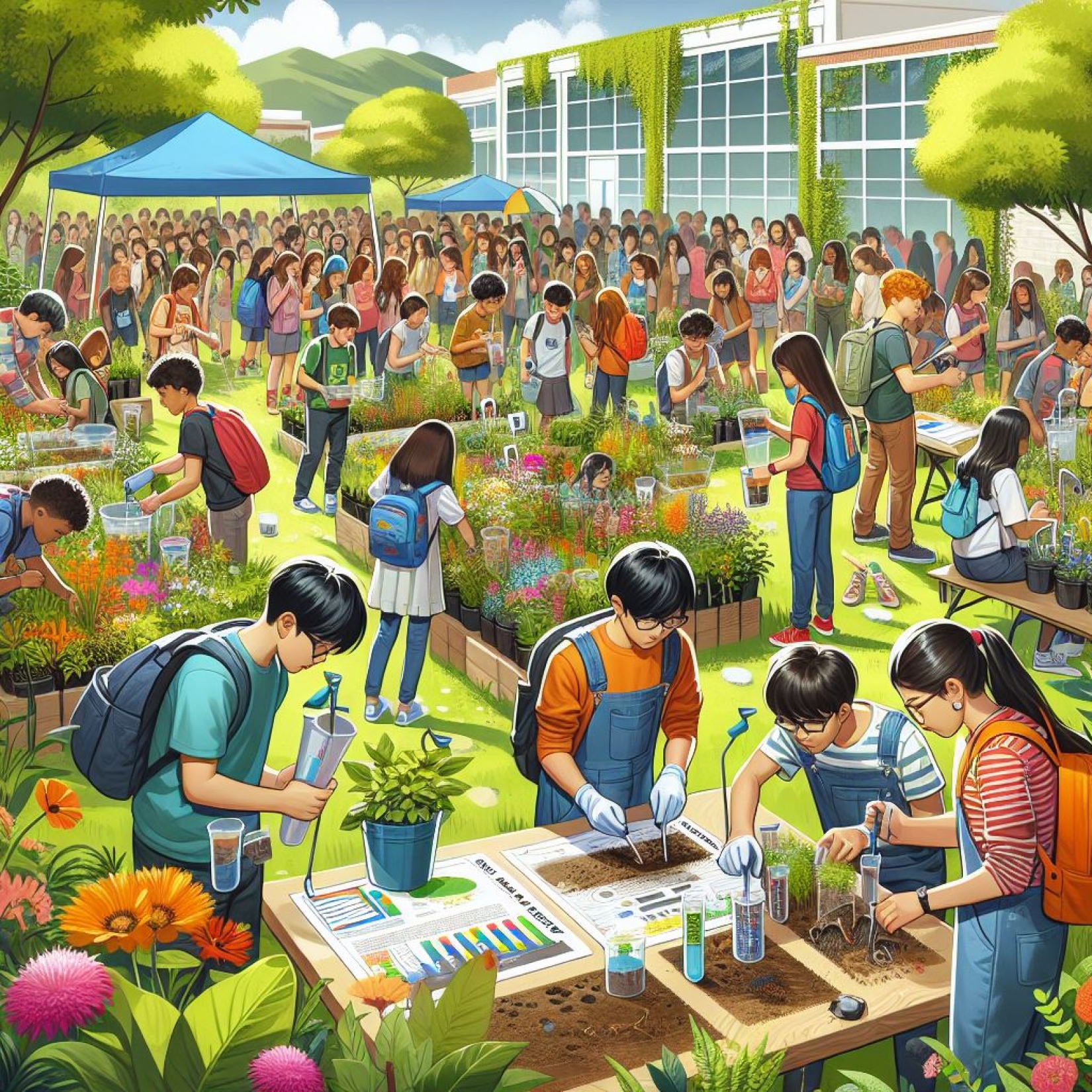
Biodiverciti
What role can you play in the biodiversity and climate crisis - in the familiar surroundings of your own garden? Citizen scientists implement biodiversity-enhancing measures in their garden, observe animals and plants and are analyzed how their attitudes and behaviors change.
What are the aims of the project?
BIODIVERCITI pursues two core research questions to analyze the impact of its intervention on Citizen Scientists and their gardens: 1. What improvements can be achieved in indicator species? BIODIVERCITI analyzes the effectiveness of adapted gardening and cultivation practices to increase biodiversity. 2. How do individual climate action and efficacy beliefs change? By transforming their own gardens, citizen scientists can develop a sense of control, even if they feel overwhelmed in the face of global crises. In contrast, experiencing personal limitations in achieving quick ecosystem improvements or feeling that they have “already done their part” can undermine subsequent climate action efforts.
How can you participate in research?
Citizen Scientists can participate in BIODIVERCITI by...
- implementing biodiversity-enhancing measures in their own garden
- observing and reporting selected indicator species
- actively exchanging information on implementation and observations with other citizen scientists and the project team
- taking part in seminars and network meetings for improving their personal knowledge and for discussing project results
- taking part in surveys on attitudes and behavior
![]()
SoilBlitz
A snapshot of soil health
With the SoilBlitz, Citizen Scientists independently carry out tests to determine local soil health, collect important data and become aware of the importance of healthy soils.
What are the aims of the project?
In a so-called ‘SoilBlitz’, five uncomplicated and fast tests are carried out to determine soil indicators such as soil texture and colour, water infiltration rate, earthworm occurrence and vegetation cover. The measurement results for these indicators are documented via an app on the ‘Soil Health Watch’ platform and then analysed. The collected data will be used in the EU project BENCHMARKS to gain an insight into the soil health of different countries and to test and optimise time- and cost-efficient methods. Based on the results, a final report will be prepared and sent to the participants.
How can you participate in research?
As part of the Citizen Science Award 2025, school classes (aged 10 and over) have the opportunity to take part in an exciting project to measure five soil health indicators. The measurements, which take between 40 and 60 minutes, can easily be carried out in a half-day school day. The results are entered in the online test protocol via an app (or optionally afterwards via a PC) in the ‘Soil Health Watch’ platform. The three school classes with the most entries in the ‘Soil Health Watch’ platform will be rewarded with prizes: €1000 for 1st place, €750 for 2nd place and €500 for 3rd place. All entries submitted by school classes during the participation period from 1 April to 5 July 2025 will be automatically counted. To register, please use the registration form on the website.
This project fulfils version 1.1 of the quality criteria for citizen science projects on Österreich forscht.
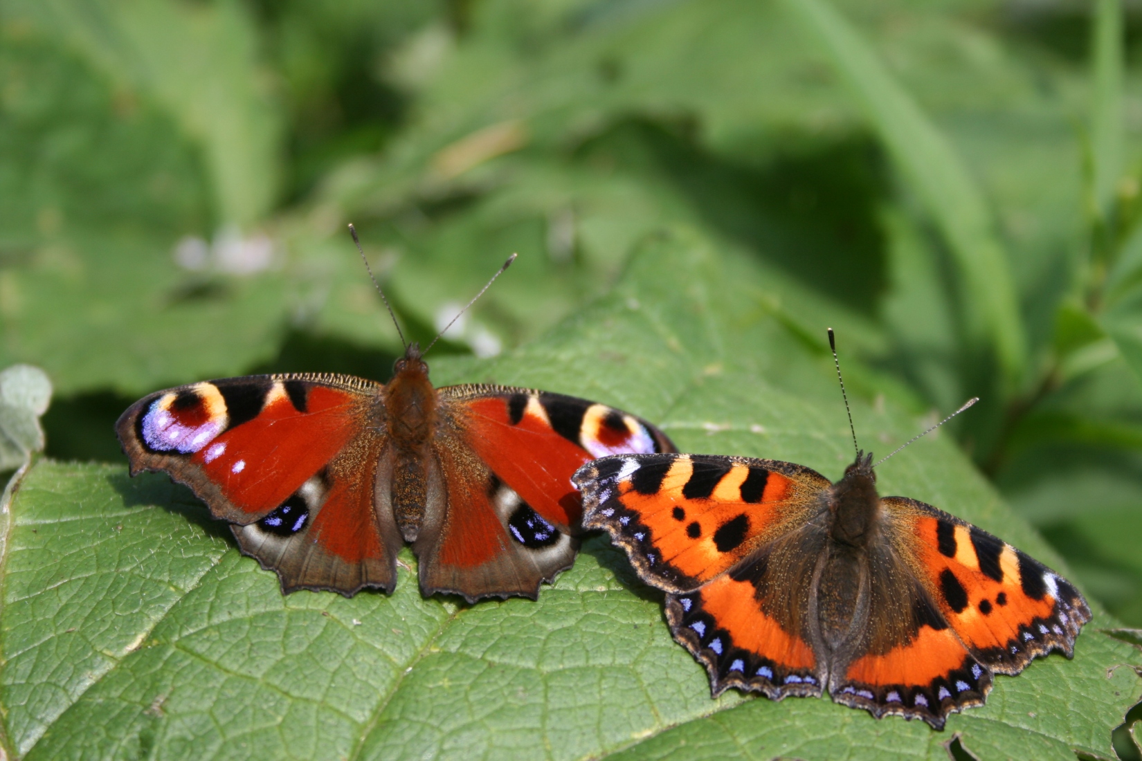
Butterfly Monitoring Austria
Many people in Austria feel that colorful butterflies are becoming increasingly rare. Unfortunately, this is also reflected in the European Grassland Butterfly Index, compiled by Butterfly Conservation Europe from datasets across the continent. Since 1990, typical grassland butterflies have declined by 36%.
Since butterfly populations naturally fluctuate from year to year, only long-term standardized monitoring can determine whether numbers are increasing or decreasing. To enable this, the initiative “Austrian Butterfly Conservation” (ABC) was established in Austria.
Where are butterflies counted?
In short: anywhere that interests you. You can count butterflies in your own garden or along a public walking path, for example. The key is to count only those butterflies flying within 5 meters in front of you or 2.5 meters to your left and right. If the observation area is large enough to walk at least 50 meters in one direction, you can even conduct a “transect survey,” which is the international gold standard.
This year, we are especially excited about observations in towns with more than 10,000 inhabitants!
When are butterflies counted?
The highest number of species and butterflies can typically be observed in July and August. If you enjoy counting, we would particularly appreciate additional observations at one- to two-week intervals. If a butterfly species is recorded at the same location three times in a year, the data can already be used to calculate the Grassland Butterfly Indicator!
Participate in four steps
- Register at „Austrian BMS“
- Install the ‘Butterfly Count’ app (available for iOS and Android)
- Familiarise yourself with butterfly species (identification aids and tips at: Links & Downloads | Austrian Butterfly Conservation )
- Observe butterflies in the garden or another location for 15 minutes in fine weather and enter them directly into the app (German or scientific name)
And don't worry, if you don't know the species, you can still enter the family 'white butterfly' or 'blue butterfly'. The more you go out, the more familiar you will become with your butterflies and you are sure to come across a surprise or two in the insect world.
Often it is necessary to catch the animals in order to identify them, as nature conservation laws vary from country to country. If you have any questions, please do not hesitate to contact us.
We at ABC would be delighted if you would like to become part of the butterfly monitoring programme and hope you have fun observing and counting! If you have any questions or comments, please email us or visit our website.
-
 Butterfly identification guide Butterfly identification guide
 - Documentation in the field Documentation in the field
- Identification workshop Identification workshop
- App for data collection App for data collection
- Excursion; (c) K. Zalneva Excursion; (c) K. Zalneva
- Hauhechel blue (the underside is important for identification) Hauhechel blue (the underside is important for identification)


https://www.citizen-science.at/en/immerse/dates/tag/land%20use#sigProIdeb1e0c0615
This project fulfils version 1.1 of the quality criteria for citizen science projects on Österreich forscht.
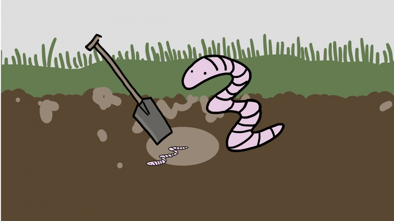
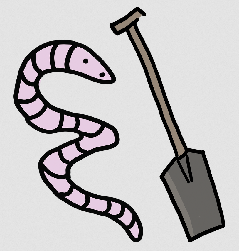
SoilRise
Monitoring of Soilbiota by Citizen Science
SoilRise is a research project on earthworm biodiversity in Europe. Earthworms play a crucial role in soil fertility and are considered important ecosystem engineers. With your help we like to collect data on the distribution and diversity of earthworms in Europe.
But SoilRise is more than scientific research. We aim to build an interactive network between researches, citizen scientists (you) and stakeholders to raise awareness of the importance of soil biodiversity. We seek to explore, protect and conserve the diverse habitats beneath our feet. By taking part in SoilRise, you will be actively contributing to the preservation of our soils and a positive impact on the environment.
Aims
The SoilRise project aims to improve the availability of data on earthworm populations and raise awareness of the biodiversity found in our soils. We aim to identify threatened or non-native earthworm species and compare traditional identification methods with DNA analysis. We will also look at species diversity in different countries to understand the ecological variation that exists.
What do we offer?
- Education and training: SoilRise offer training courses that teach the basics of soil ecology and sampling. There are also workshops that provide in-depth knowledge about earthworms.
- Engagement and impact: Your participation supports our scientific research project and makes a direct contribution to environmental protection. By sampling at different sites you will increase your knowledge of soil biodiversity.
- Community and networking: Become part of the SoilRise network, sharing ideas and networking with other participants and experts.
- Sampling and effort: Your participation is flexible, you can start, stop and continue as you wish between October 2024 and 2026. The effort per site is about 5h.
- Meet and greet: Discover the soil beneath your feet, meet interesting people and experience nature from a new perspective.
Sampling
Sample your field with a spade during the months of March to May and/or September to November. Sampling takes approximately 5 hours and you can record your data on the form provided or on our website. Our team will help you every step of the way, on site if possible.
We will provide all necessary documents such as sampling instruction and data sheets. Our seminars and webinars will to help you to prepare for sampling and you will learn more about the world of earthworms.
At our networking sessions, we will invite you to share your experiences with other participants and the research team.
Who could participate?
Anyone over the age of 14 can take part in the project and search for earthworms (farmers, gardeners, agricultural schools and everyone who is interested).
We have three categories:
- field (arable fields including large scale vegetable production, viticulture),
- small vegetable beds and flower beds (home garden, community garden, town garden, market gardening)
- lawn/meadow, grassland and green spaces (lawns, natural meadows, agricultural grassland)
It is also possible to take part in the project without having a own plot of land.
Register directly at our project website.
SoilRise is a biodiversa+ project in cooperation with Germany, France, Ireland, Poland and Austria.
This project fulfils version 1.1 of the quality criteria for citizen science projects on Österreich forscht.
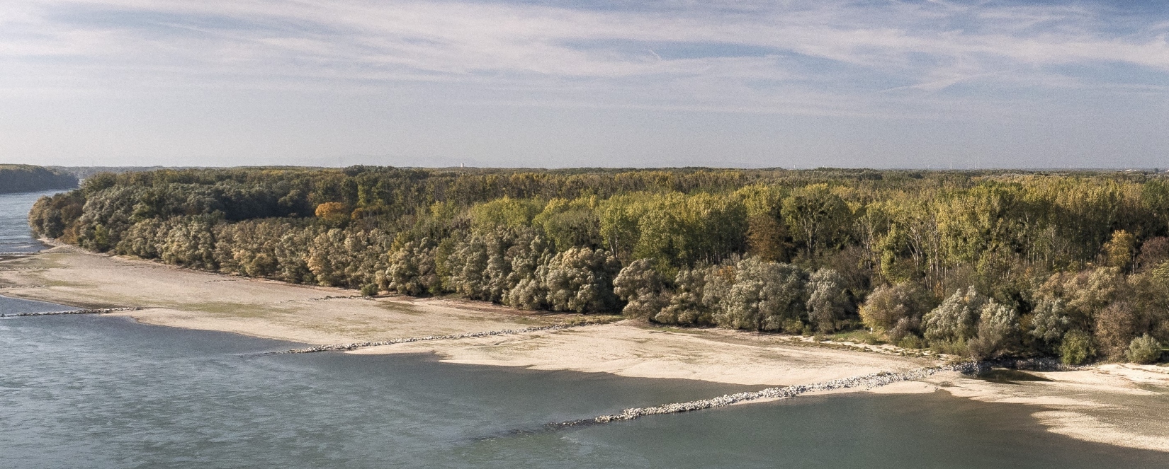
DANUBE4all
DANUBE4all is an EU project with the main task of developing a comprehensive action plan for the renaturation of river stretches in the Danube River Basin (DRB). To this end, a collaborative stakeholder process is being developed that actively incorporates the interests of citizens. The action plan is intended to contribute to the improvement of the ecological status, biodiversity and river connectivity of the Danube ecosystems and thus supports the EU mission OCEAN ‘Mission Healthy Oceans, Seas, Coastal and Inland Waters’.
The development and implementation of innovative and socially relevant nature-based solutions has a wide range of positive effects. In addition to the improved connectivity of rivers, possible scenarios for floodplains, reducing the risk of floods and droughts, and other socio-economically effective measures are an important focus. Renaturation projects on the Danube are being promoted with the goal of improving the continuity of sediments and positively influencing habitats/biota. These include the Danube National Park east of Vienna, a section of the river in Hungary and a measure on the Danube delta.
Nature-based solutions must be developed in collaboration with the affected population and supported by them in order to be effective in the long term. Renaturation processes tend to unfold slowly and require continuous attention and active support in order to be successful. Accordingly, the intensive involvement of citizens along the Danube is an important component that makes renaturation possible in the first place. A special work package supports interaction with citizens through the activation of citizen science. Citizen scientists are particularly involved in the development, implementation, evaluation and scaling of nature-based solutions, a citizen science method toolbox, and the development of communication measures.
In particular, DANUBE4all serves the following research fields:
- Criteria and indicators for physical connectivity status as a starting point for renaturation options in the Danube catchment. A reflection of existing assessment methods and initiatives contributes to this.
- Analysing the (ecological) status of water bodies and biodiversity with the aim of expanding the existing transnational biodiversity monitoring with a strong focus on restoration. This includes long-term trends in connection with management and conservation measures associated with renaturation.
- Co-creation, implementation and results monitoring of nature-based solutions implemented in the project in the Danube River Basin. This includes:
- 3 restoration interventions with the participation of local residents (3 Demonstration Sites);
- the further use and replication of solutions in 5 Associated Regions;
- later a multiplication of the approach by supporting 10 restoration measures (10 Synergy Sites).
- Implementation of socially relevant integrative measures with municipalities in the Danube River Basin. This includes measures that trigger social and economic change, as well as the sustainable, integrative and long-term management of restored ecosystems through public mobilisation and engagement. This is also to be achieved through citizen science.
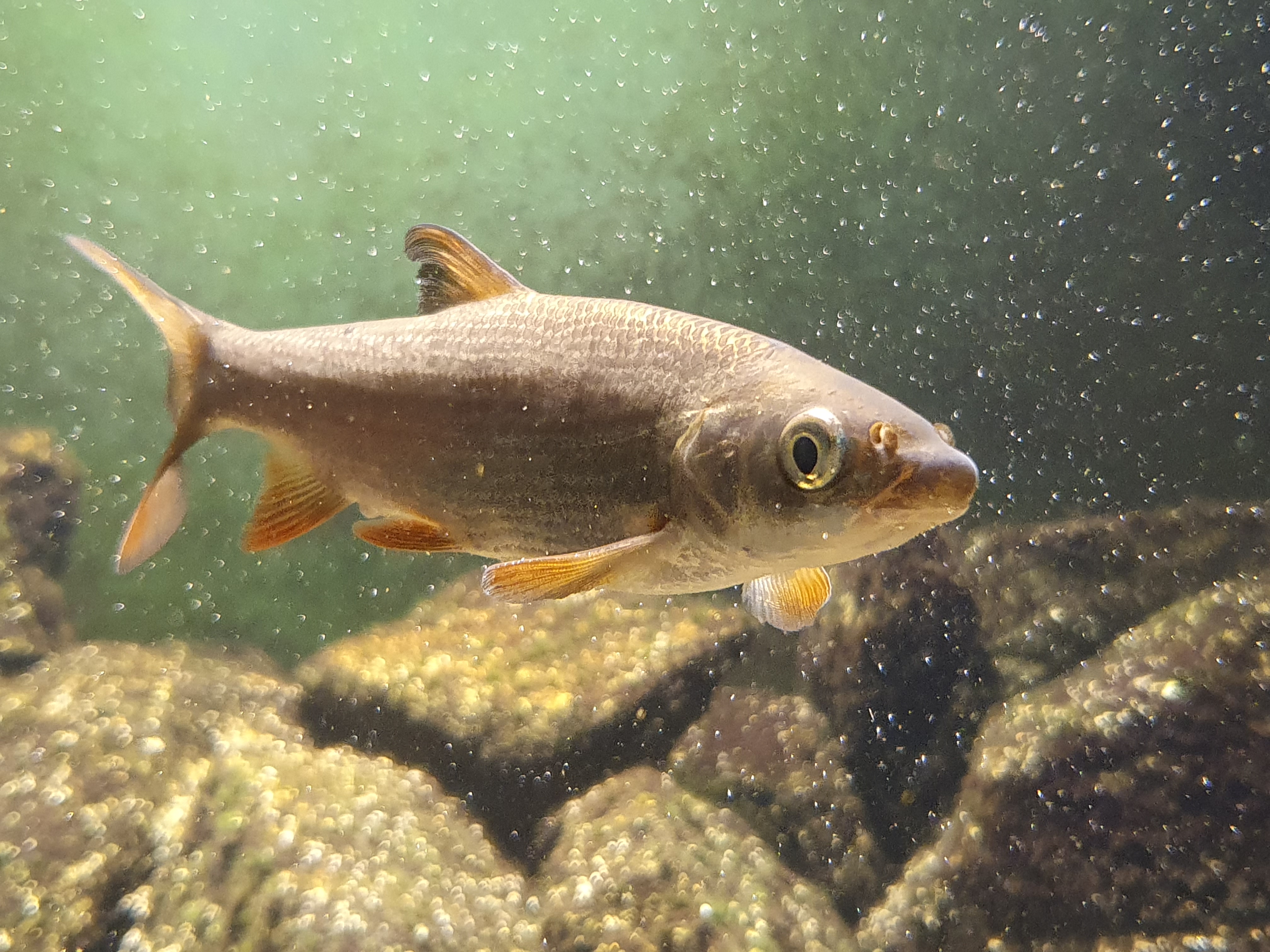
common nase, © Robert Togel (Images courtesy of viadonau)
This project fulfils version 1.1 of the quality criteria for citizen science projects on Österreich forscht.
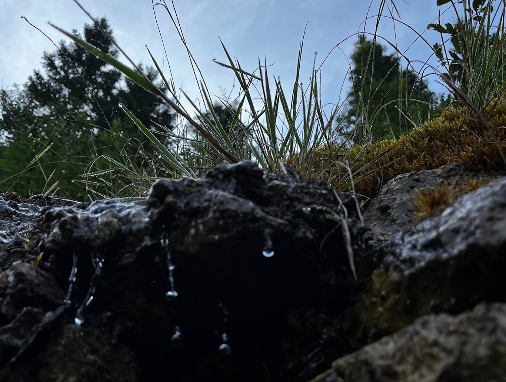
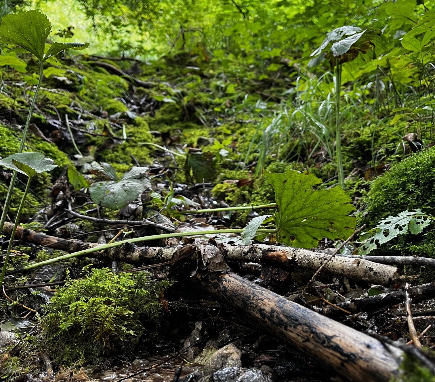
On the trail of springs
Spring habitats in the Großes Walsertal Biosphere Reserve
In view of increasing extreme weather events, including periods of drought and consequent water shortages, the protection and knowledge of springs in the Großes Walsertal Biosphere Reserve is becoming increasingly important. In addition to their essential role in water supply, springs are often small but very important habitats for endangered organisms. The pressure to utilise and develop existing springs has increased significantly due to climate change. In order to raise awareness of these special habitats and obtain an overview of the existing spring habitats in the valley, the KLAR! Biosphärenpark Großes Walsertal is launching a citizen science project in cooperation with Life Science AG.
As an introduction, an online workshop will take place on 18 February 2025 from 19:00 to 20:30. Participants will gain exciting insights into the hidden world of springs, their ecological value for highly specialised species and the importance of certain organisms as indicators of water quality. They will also be shown how climate change and increasing utilisation pressure are affecting these sensitive habitats. Finally, the methodology of spring mapping will be presented and a typical mapping day outlined. After the workshop, interested parties will have the opportunity to secure a place on the field trip in summer 2025, during which the methodology will be applied in the field.
Life Science AG has already successfully carried out a citizen science project to record spring habitats in the Black Forest biosphere area and will now transfer this project to the conditions in the Großes Walsertal. The tried-and-tested mapping and evaluation method records not only the location but also characteristics such as spring size, temperature, cultural-historical significance, flora and fauna as well as potential human influences. As an alternative to the tried-and-tested analogue recording, the Qfield app is also being adapted so that walks in the Großes Walsertal can become small research trips.
As a model region for sustainable development, the biosphere reserve bears a special responsibility for the long-term protection of natural springs. We are committed to securing the supply of drinking water and at the same time protecting the habitat for rare species. At the same time, we must ensure that the springs are utilised in the most environmentally friendly way possible to provide water for humans and animals.
If you are interested, please register in advance with our Klar! manager - Lukas Ellensohn at This email address is being protected from spambots. You need JavaScript enabled to view it.. He will send you all further details and the link to the online workshop.
This project fulfils version 1.1 of the quality criteria for citizen science projects on Österreich forscht.
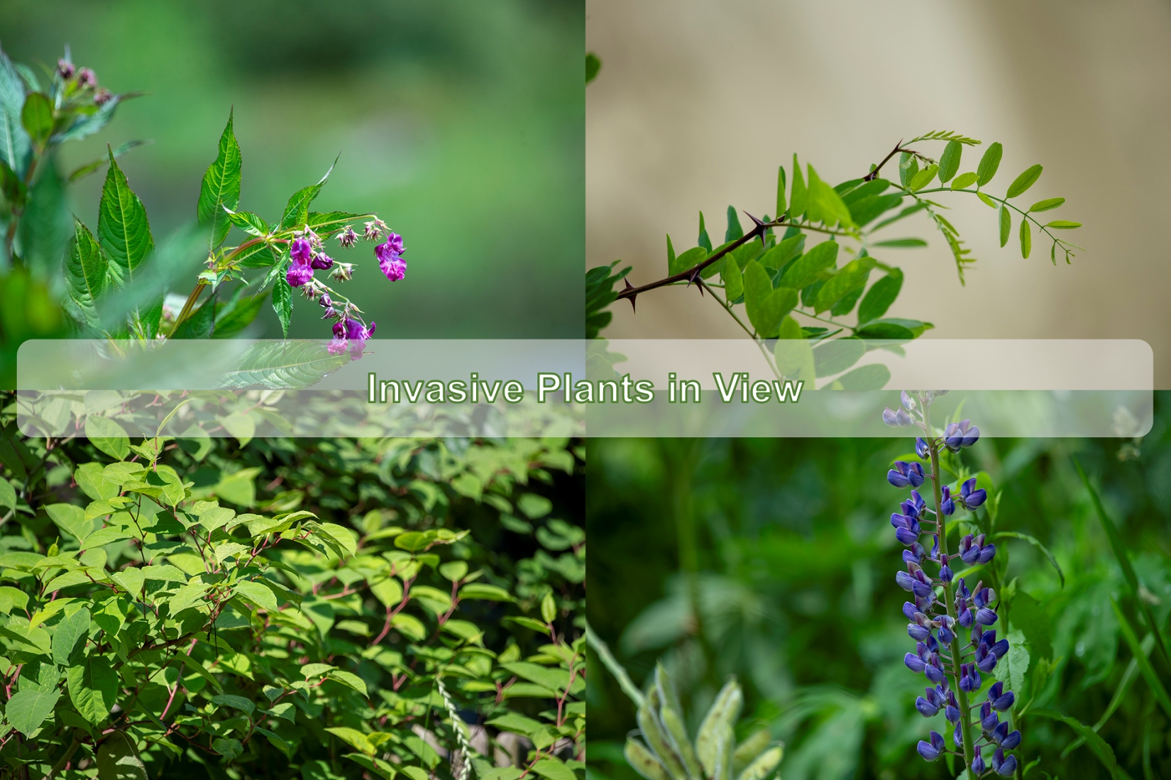
Invasive Plants in View
Monitoring in the Karawanken UNESCO Global Geopark
Together we can limit the spread of invasive species and protect the biodiversity of our mountain regions!
Introduction
Our Citizen Science project is dedicated to monitoring invasive alien species (IAS) in the mountain regions of the Karawanken Geopark. Invasive species are plants or animals introduced by human activity into regions where they do not originally occur, often through intercontinental trade. While most introduced species rely on human support to survive, some can adapt and thrive independently. A subset of these become invasive, posing significant threats to native ecosystems.
Problem Definition
Invasive alien species spread rapidly because they produce large quantities of seeds, grow quickly, and have few natural enemies in their new environment. This allows them to colonize new areas swiftly and displace native species. They can also affect water supplies, agriculture, and human health.
Mountain regions are less affected by invasive plants, but the risk is increasing due to climate change and human land use. These species are often introduced at lower altitudes and spread along corridors such as roads, hiking trails, and watercourses to higher altitudes. Seeds and spores can stick to tires, shoes, and tools, facilitating their spread. Intentionally introduced plants, such as seed mixtures for roadsides or ski slopes and ornamental plants, also contribute to their spread.
Once invasive species appear in mountainous regions, they are difficult to control due to the challenging terrain. To take appropriate measures, it is essential to monitor the populations of these species in the Geopark.
- Canadian goldenrod (Solidago canadensis) CC-BY 2.0 Andreas Rockstein Canadian goldenrod (Solidago canadensis) CC-BY 2.0 Andreas Rockstein
- Japanese knotweed (Fallopia japonica) © Urosh Grabner Japanese knotweed (Fallopia japonica) © Urosh Grabner
- Black locust (Robinia pseudoacacia) © Urosh Grabner Black locust (Robinia pseudoacacia) © Urosh Grabner
- Bigleaf lupine (Lupinus polyphyllus) © Urosh Grabner Bigleaf lupine (Lupinus polyphyllus) © Urosh Grabner
- Himalayan balsam (Impatiens glandulifera) © Urosh Grabner Himalayan balsam (Impatiens glandulifera) © Urosh Grabner


https://www.citizen-science.at/en/immerse/dates/tag/land%20use#sigProId75c9df7eb2
Project Area
The Karawanken UNESCO Global Geopark covers an area of 1,067 km² and includes five Slovenian and nine Austrian municipalities. This cross-border area is a unique natural and cultural experience region characterized by its outstanding geological heritage. The aim of the Geopark is to preserve the geological and natural resources as well as the cultural heritage of its members. By raising awareness, providing information, and education about the Geopark and its network at European and global levels, it contributes to strengthening its position as an important geopark. The Geopark also promotes economic use through sustainable tourism and supports cross-border cooperation for the sustainable development of the region.
Further information about the Karawanken Geopark can be found on the Geopark homepage.
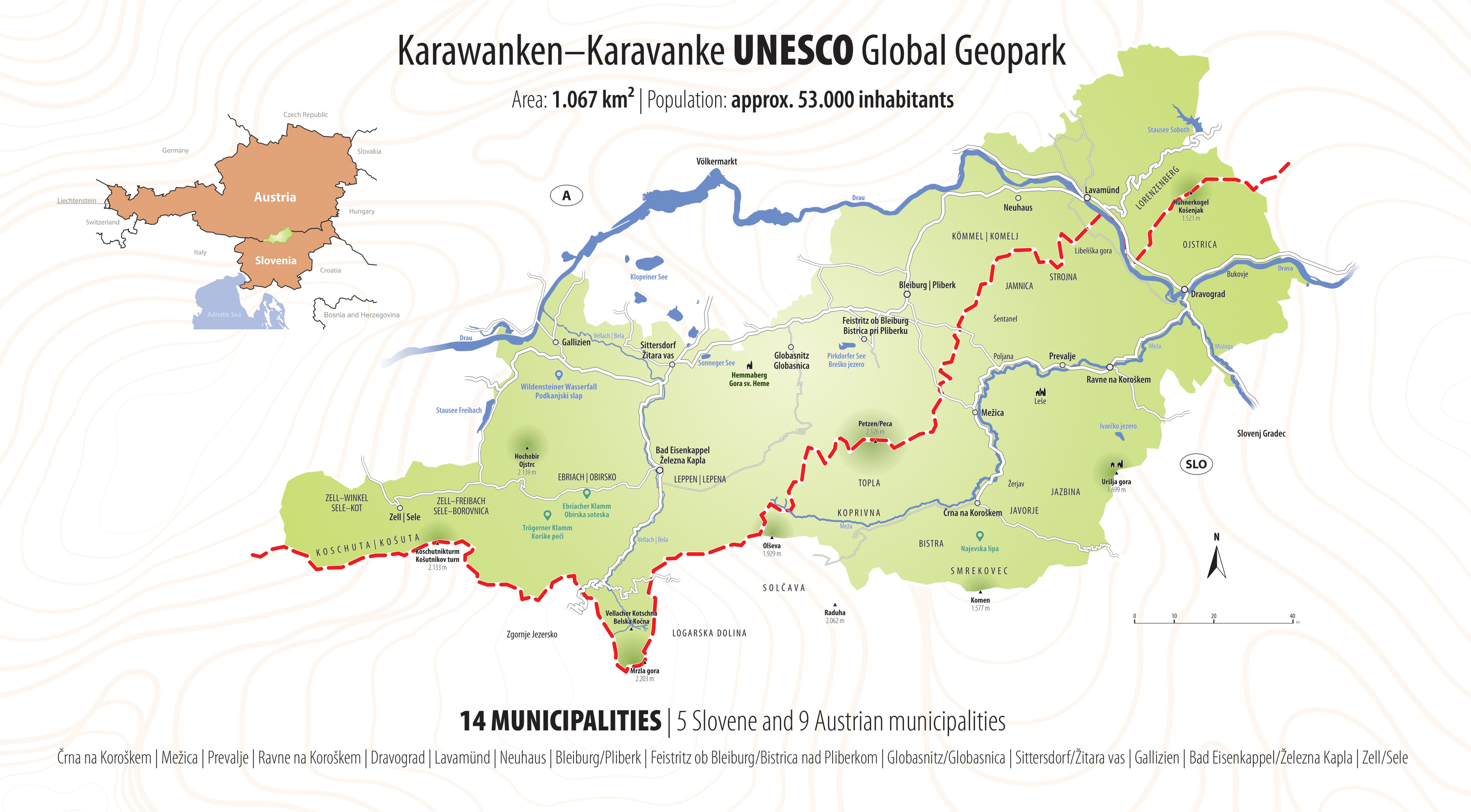
Image 3: Overview map Karawanken UNESCO Global Geopark © Urosh Grabner
Project Goals
- Monitoring and Early Detection: Establishing a network to monitor invasive species in the Karawanken UNESCO Global Geopark in order to detect their spread at an early stage.
- Awareness-Raising and Education: Informing and involving the population about the importance and impact of invasive alien species and the influence of climate change and human activities on their spread.
- Data Collection and Analysis: Collecting and analyzing data on the occurrence and spread of invasive species by citizen scientists.
- Management and Control: Developing an action plan to control and contain invasive species in order to protect native ecosystems.
Methodology
- Participation: Involving the population as citizen scientists who collect data on the occurrence and spread of invasive species.
- Training and Workshops: Providing online educational materials and workshops to equip participants with the necessary knowledge and skills to identify and report invasive species.
- Online Green Academy
- Workshops
- Data Platform: Using the iNaturalist platform to record the locations of plant species. The collected data is validated there and then analyzed and published by the Carinthia University of Applied Sciences (UNESCO Chair for Sustainable Management of Protected Areas).
Expected Results:
- Improved Data Basis: Basic data collection on the occurrence and spread of invasive species in the Karawanken Geopark.
- Increased Awareness: Better-informed and engaged population actively contributing to monitoring and protecting native ecosystems.
- Effective Management Strategies: Action plan to control and contain invasive species in hard-to-reach areas.
How Can I Take Part?
We invite all interested citizens to join our project and help protect the unique mountain ecosystems of the Karawanken Geopark. You can actively contribute by photographing foreign plants in the Karawanken Geopark and uploading them to iNaturalist.
Using the iNaturalist app, you can photograph any animal or plant. The app identifies the species using artificial intelligence, and the iNaturalist community can confirm or improve your discovery, enhancing the quality of observations over time.
Information about the five most common species in the Karawanken Geopark, their impact, and recognition tips can be found in our project journal on iNaturalist.
Simple Guide to Get Started
- Download the App: Get the iNaturalist app from your app store (available for iOS and Android).
- Create an Account: If you don't have an iNaturalist account, (quick and free!).
- Join Our Project: After registering, search for our project "Invasive Alien Species - Karawanken-Karavanke UNESCO Global Geopark"
- Add Your Observation: If you spot an unfamiliar plant in the Karawanken Geopark, use the iNaturalist app to:
- Take Photos: Clear images of the plant and its surroundings.
- Notes: Estimate the number of plants and their area coverage (e.g., few, medium, many).
- Location: Allow the app to access your location or manually select it on the map.
- Submit Your Observation: Enter all required information and submit your observation. Your contribution helps monitor invasive alien plants and protects our environment.
Video 1: What is iNaturalist?
Data Protection Information
No participant data is analyzed in this project. By joining, participants agree to iNaturalist's terms of use. Users control what data is visible to others when creating iNaturalist data, and settings can be managed in account details on the platform.
Project Details and Contact
This project is co-funded by the INTERREG Central Europe project HUMANITA - Human-Nature Interactions and Impacts of Tourism Activities on Protected Areas, supported by the Interreg CENTRAL EUROPE Program 2021-2027 with co-financing from the European Regional Development Fund (ERDF). The project's total budget is EUR 2,396,346.70, with EUR 1,917,077.36 funded by ERDF.
For questions or more information, please contact:
Project Management, FH Kärnten: Lilia Schmalzl (This email address is being protected from spambots. You need JavaScript enabled to view it.)
Project Management EVTZ Geopark Karawanken: Urosh Grabner (This email address is being protected from spambots. You need JavaScript enabled to view it.)
This project fulfils version 1.1 of the quality criteria for citizen science projects on Österreich forscht.
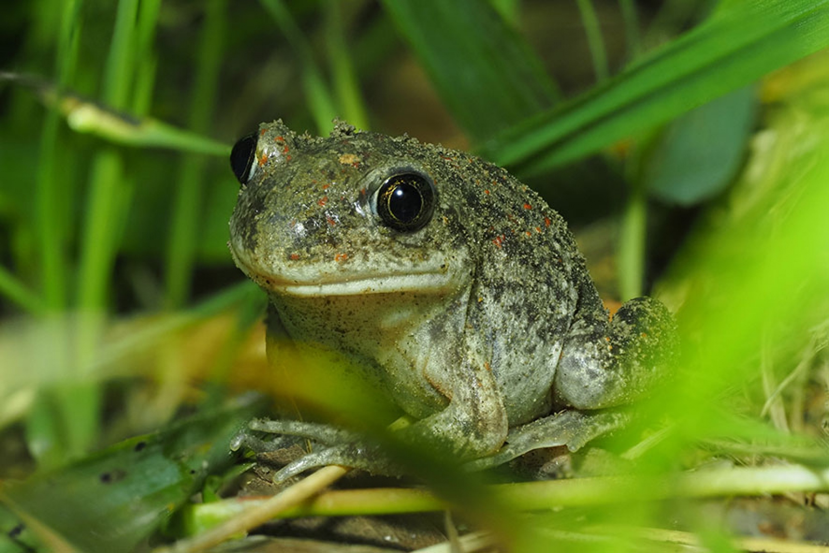
Frog in a drop of water
State-of-the-art DNA technology and citizen science - "Frog in a drop of water" unleashes new prospects for amphibian research
Detective work for amphibian protection - for the first time, amphibian screening is being carried out throughout Austria by detecting their DNA traces in water - and everyone can take part. Amphibians - including frogs, toads, toads, salamanders and newts - are strictly protected in Austria. Nevertheless, populations are continuously and in some cases dramatically declining, which is mainly due to habitat loss.

Natural, private garden ponds can play an important role. They act as important possible retreats, but are usually not accessible to the public. In addition, there are often small and amphibian-rich waters that are only known to those familiar with the area. This is where citizen scientists come into play: Their efforts make a valuable contribution to species records and data on the distribution of the amphibian fungus Batrachochytrium dendrobatidis, or Bd.

Interessierte aus ganz Österreich konnten sich bis Ende März bewerben, Ende April wurden 1.120 Beprobungskits versendet. Über eine kinderleichte Probennahme können die kostbaren DNA-Spuren, die von Lebewesen im Wasser hinterlassen werden, herausgefiltert werden. Durch eine einfache Wasserprobe kann also die Artenvielfalt im Teich, sowie das Vorkommen von Bd erfasst werden. Dazu wird der fertige Filter an die Uni gesandt, im High-Tech Labor analysiert und bioinformatisch ausgewertet. Die Ergebnisse werden im Herbst 2024 veröffentlicht.
")
Videos zum Projekt
![]()
This project fulfils version 1.1 of the quality criteria for citizen science projects on Österreich forscht.

Market garden centres
Innovation to strengthen the Austrian fresh vegetable supply
Market garden centres work according to so-called bio-intensive methods. This means utilising the maximum possible natural yield potential on the land. This yield potential results from the respective location, the climatic conditions (temperature, precipitation, wind, etc.), the production methods and, to a large extent, the soil itself. Beside the type of soil and texture, the thickness of the individual soil layers, the condition of the soil in terms of soil fertility and soil health is of enormous importance for market gardeners. While the term soil fertility refers more to the function of productivity (mineral, physical and biological aspects), the term soil health is defined more systemically and expanded to include other soil functions. In addition to the productivity function, the water storage function, the habitat function for plants and soil organisms and their diversity, the nutrient management function and the climate function as a carbon store are relevant for market garden centres. In order to run a market garden successfully and sustainably, the soil condition in terms of its fertility and health must not only be maintained, but even improved in the course of cultivation. The goal in every market garden is therefore not only sustainable soil management, but also regenerative soil management. In this project, soil data such as aggregate stability, soil structure, temperature, moisture, infiltration, degree of mulch cover and compaction data are collected according to scientific principles. Data such as the degree of mulch coverage is collected directly from the gardeners, as we collect the data at 14-day intervals. The respective test facilities and test questions were customised together with the respective farm, as we attach great importance to practical questions.
For this project, participation is closed.
This project fulfils version 1.1 of the quality criteria for citizen science projects on Österreich forscht.
Restore4Life
What can we do to protect our wetlands and floodplains in Europe? What does the water management need to implement measure for the benefit of both the environment and the human society?
The Horizon Europe project Restore4Life aims at offering an online system that supports the restoration of wetlands in Europe. One important aspect is the development of easily applicable and meaningful methods to assess the state and functionality of wetlands before and after the restoration. This enables us to see whether the measures are sustainable for the future of the wetlands, for the climate and for us.
Why Citizen Science?
The integrity of wetlands can be assessed via a multitude of factors. Biodiversity indicates the health of the ecosystem, plant biomass shows how much carbon can be stored. In order to assess these data across Europe, we need methods which can be used also by non-experts. Together with Citizen Scientists, we want to develop, adapt, test, and optimize such methods so that we can offer them to other countries willing to implement restoration activities. We especially invite school classes to participate in our project.
The opportunities for joining the project are manifold: you can determine bird species via their songs, estimate the diameter and height of trees, evaluate orthophotos and satellite images, and many other things.
Where:
- March-Thaya-floodplains near Hohenau
- Salzach-Floodplains

This project fulfils version 1.1 of the quality criteria for citizen science projects on Österreich forscht.