
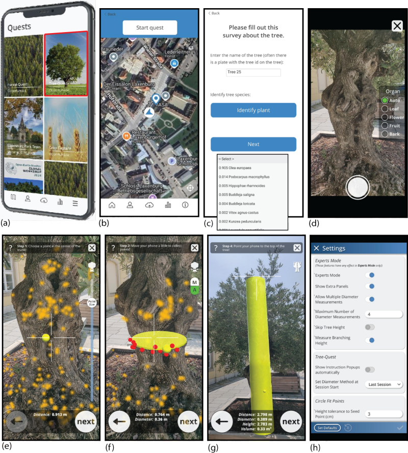
Tree-Quest
The Tree-Quest project aims at developing an Austrian citizen science (CS) data component to bridge the in-situ data gap for more reliable forest mapping with Copernicus satellite data.
What are the aims of the project?
We’re inviting everyone to join our new citizen science campaign through the free Geo-Quest app. Using the Tree-Quest module, you can head outside and measure trees in your neighborhood — and discover how much carbon they store! You’ll learn how trees help fight climate change and see how many trees it takes to balance out the carbon emissions from things like driving or flying. The data you collect will also support scientists in creating better maps of carbon stored in forests, using satellite images from space.
How can you participate in the research?
How to Join the Tree Quest Carbon Campaign: Simple Steps
- Download the Geo-Quest app - Get the free app on your smartphone from the App Store or Google Play.
- Open the Tree-Quest module Launch the app and select the Tree-Quest feature to start measuring trees.
- Find a tree near you - Head outside and pick a tree in your neighborhood, park, or nearby green space.
- Measure the tree - Use the app to measure the tree’s diameter and height. Identify the tree species if you can.
- Submit your data - Enter the measurements into the app and send your data to help scientists.
- Repeat and explore -Measure more trees around you to contribute even more valuable information
- Share your impact -Tell friends and family about the campaign and encourage them to join!
![]()

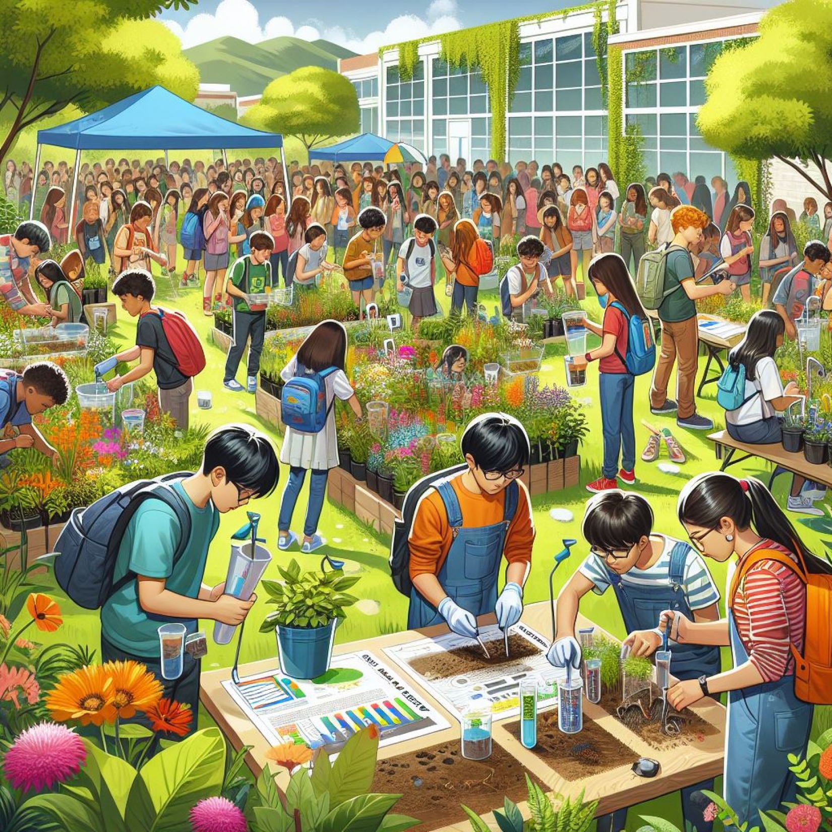
Young Citizen Science PolliDiversity
In the PolliDiversity project, students explore flowering areas and observe pollinating insects like wild bees. Using digital tools, they collect scientific data and learn how to protect and experience biodiversity.
What are the aims of the project?
In the PolliDiversity project, students investigate the development of flowering areas using the ReNatura® BW3 Gumpenstein wildflower mixture, observe wild bees and other pollinators, and collect scientific data using digital tools. The goal is to raise young people's awareness of the importance of biodiversity and actively involve them in scientific research. The project is accompanied by a biology education study conducted by the Paris Lodron University of Salzburg, which examines how students’ well-being, emotions, environmental awareness, ecological understanding, species knowledge, and connection to nature change through participation. Additionally, the impact of mindfulness is being explored in a comparison group.
How can you participate in research?
Interested schools can register as project partners and participate with their classes. Students create flowering areas, observe pollinators, and document their findings using digital tools and standardized protocols. They are supported by teaching materials, explainer videos, and booklets. Individuals can also engage by accessing the project’s digital platforms, sharing experiences, and supporting the initiative. All relevant information on how to participate is available on the project website and in the project brochure.
-
 Students planting the flowering area Students planting the flowering area
 - Students identifying the plants Students identifying the plants
- red mason bee (Osmia bicornis) red mason bee (Osmia bicornis)


https://www.citizen-science.at/en/about/about-oesterreich-forscht/tag/plants#sigProId5b5de21b2a
![]()

city-tree-soil
In the City-Tree-Soil project, the Federal Research Centre for Forestry (BFW), the Federal Environment Agency (UBA), the University of Natural Resources and Life Sciences (BOKU) and the University of Innsbruck are investigating the growth conditions of urban trees in Vienna and Innsbruck. Citizen scientists (schools and the general public) are responsible for recording the growth in thickness. In addition, soil carbon is being measured in both cities.
What are the aims of the project?
The project aims to answer three research questions.
- Quantification of the impact of urban tree stands on the growth, carbon storage, water storage and infiltration capacity of urban soils.
- Contributions to determining the carbon balance for the urban areas of Vienna and Innsbruck.
- Communicating the importance of urban trees for humans and the microclimate, and the necessary functions of the soil for this purpose, to society.
How can you participate in research?
Schools and the general public are encouraged to measure the growth of specially selected trees as often and regularly as possible. This is done by reading a value on a scale (dentrometer) attached to the tree. The value is entered into a form on a smartphone using a QR code and sent. No personal data is collected.

Biodiverciti
What role can you play in the biodiversity and climate crisis - in the familiar surroundings of your own garden? Citizen scientists implement biodiversity-enhancing measures in their garden, observe animals and plants and are analyzed how their attitudes and behaviors change.
What are the aims of the project?
BIODIVERCITI pursues two core research questions to analyze the impact of its intervention on Citizen Scientists and their gardens: 1. What improvements can be achieved in indicator species? BIODIVERCITI analyzes the effectiveness of adapted gardening and cultivation practices to increase biodiversity. 2. How do individual climate action and efficacy beliefs change? By transforming their own gardens, citizen scientists can develop a sense of control, even if they feel overwhelmed in the face of global crises. In contrast, experiencing personal limitations in achieving quick ecosystem improvements or feeling that they have “already done their part” can undermine subsequent climate action efforts.
How can you participate in research?
Citizen Scientists can participate in BIODIVERCITI by...
- implementing biodiversity-enhancing measures in their own garden
- observing and reporting selected indicator species
- actively exchanging information on implementation and observations with other citizen scientists and the project team
- taking part in seminars and network meetings for improving their personal knowledge and for discussing project results
- taking part in surveys on attitudes and behavior
![]()
SoilBlitz
A snapshot of soil health
With the SoilBlitz, Citizen Scientists independently carry out tests to determine local soil health, collect important data and become aware of the importance of healthy soils.
What are the aims of the project?
In a so-called ‘SoilBlitz’, five uncomplicated and fast tests are carried out to determine soil indicators such as soil texture and colour, water infiltration rate, earthworm occurrence and vegetation cover. The measurement results for these indicators are documented via an app on the ‘Soil Health Watch’ platform and then analysed. The collected data will be used in the EU project BENCHMARKS to gain an insight into the soil health of different countries and to test and optimise time- and cost-efficient methods. Based on the results, a final report will be prepared and sent to the participants.
How can you participate in research?
As part of the Citizen Science Award 2025, school classes (aged 10 and over) have the opportunity to take part in an exciting project to measure five soil health indicators. The measurements, which take between 40 and 60 minutes, can easily be carried out in a half-day school day. The results are entered in the online test protocol via an app (or optionally afterwards via a PC) in the ‘Soil Health Watch’ platform. The three school classes with the most entries in the ‘Soil Health Watch’ platform will be rewarded with prizes: €1000 for 1st place, €750 for 2nd place and €500 for 3rd place. All entries submitted by school classes during the participation period from 1 April to 5 July 2025 will be automatically counted. To register, please use the registration form on the website.
Picture gallery
- © AGES/Lehmann © AGES/Lehmann
- © AGES/Lehmann © AGES/Lehmann
- © AGES/Lehmann © AGES/Lehmann
- © AGES/Lehmann © AGES/Lehmann
- © AGES/Lehmann © AGES/Lehmann
- © AGES/Lehmann © AGES/Lehmann
- © AGES/Lehmann © AGES/Lehmann
- © AGES/Lehmann © AGES/Lehmann


https://www.citizen-science.at/en/about/about-oesterreich-forscht/tag/plants#sigProId89858b7c4c
This project fulfils version 1.1 of the quality criteria for citizen science projects on Österreich forscht.
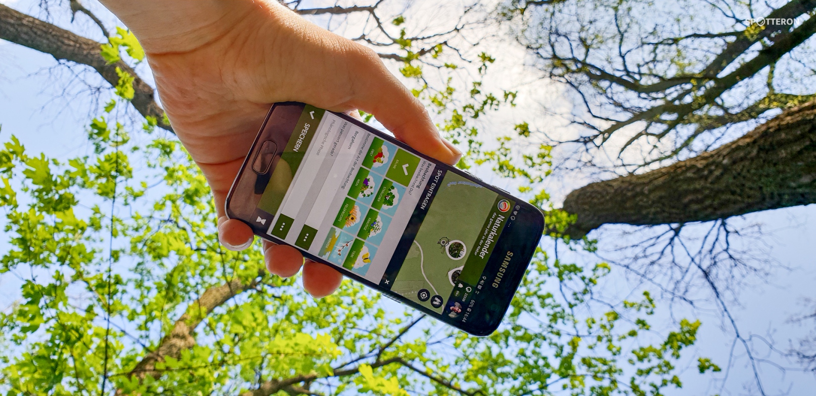
Phänologie - Naturkalender - Phenowatch
Since 1851, we have been researching the changes in weather, climate and nature and what this means for us humans by observing plants and animals. These phenological observations help, for example, in climate research, agriculture and pollen forecasting in order to better deal with climate change.
What are the aims of the project?
Plants act as an integrating measuring instrument for a variety of environmental factors such as weather conditions in the past and current vegetation year. If one analyzes the temporal course of phenological observation data, the influencing factor of air temperature becomes clear, especially in the spring phases in Austria, both in short-term fluctuations and in long-lasting trends. Phenology is therefore an ideal bio-indicator for gradual changes in the climate. Research objectives include
- Climate monitoring in addition to instrumental measurements.
- Temperature sensitivity of phenological events - Does the sensitivity of plants change with the temporal shift of phenological phases?
- Groundtruthing of vegetation indices from satellite observations.
- Further basic plant physiological research - future phenological modeling on an even more plant process-oriented basis.
How can you participate in research?
Find your favorite trees and shrubs in your favorite location and observe and document their development from bud burst and the start of flowering to fruit ripening, leaf coloration and leaf fall through the ten phenological seasons. We are looking for the date for the start of the respective development phases of the so-called indicator plants. You can send this to us in the "Nature Calendar" app with a photo or in the traditional way using a paper form. You can find all the information you need on our website.
- Important indicator plants Important indicator plants
- Snowdrop blossom Snowdrop blossom
- Black elderberry Black elderberry


https://www.citizen-science.at/en/about/about-oesterreich-forscht/tag/plants#sigProId2b82b6fefd
Podcast episode
In May 2025, Thomas Hübner (GeoSphere Austria) and Maximilian Bastl (Pollenservice of MedUni Wien) reported on phenological research in our Österreich forscht podcast Wissen macht Leute - you can listen to the episode here (in German).

This project fulfils version 1.1 of the quality criteria for citizen science projects on Österreich forscht.
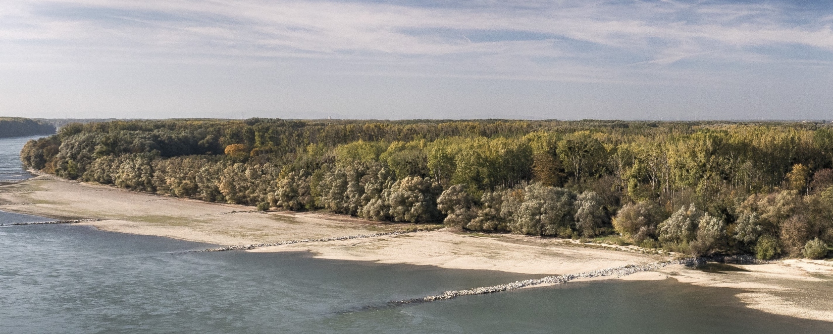
DANUBE4all
DANUBE4all is an EU project with the main task of developing a comprehensive action plan for the renaturation of river stretches in the Danube River Basin (DRB). To this end, a collaborative stakeholder process is being developed that actively incorporates the interests of citizens. The action plan is intended to contribute to the improvement of the ecological status, biodiversity and river connectivity of the Danube ecosystems and thus supports the EU mission OCEAN ‘Mission Healthy Oceans, Seas, Coastal and Inland Waters’.
The development and implementation of innovative and socially relevant nature-based solutions has a wide range of positive effects. In addition to the improved connectivity of rivers, possible scenarios for floodplains, reducing the risk of floods and droughts, and other socio-economically effective measures are an important focus. Renaturation projects on the Danube are being promoted with the goal of improving the continuity of sediments and positively influencing habitats/biota. These include the Danube National Park east of Vienna, a section of the river in Hungary and a measure on the Danube delta.
Nature-based solutions must be developed in collaboration with the affected population and supported by them in order to be effective in the long term. Renaturation processes tend to unfold slowly and require continuous attention and active support in order to be successful. Accordingly, the intensive involvement of citizens along the Danube is an important component that makes renaturation possible in the first place. A special work package supports interaction with citizens through the activation of citizen science. Citizen scientists are particularly involved in the development, implementation, evaluation and scaling of nature-based solutions, a citizen science method toolbox, and the development of communication measures.
In particular, DANUBE4all serves the following research fields:
- Criteria and indicators for physical connectivity status as a starting point for renaturation options in the Danube catchment. A reflection of existing assessment methods and initiatives contributes to this.
- Analysing the (ecological) status of water bodies and biodiversity with the aim of expanding the existing transnational biodiversity monitoring with a strong focus on restoration. This includes long-term trends in connection with management and conservation measures associated with renaturation.
- Co-creation, implementation and results monitoring of nature-based solutions implemented in the project in the Danube River Basin. This includes:
- 3 restoration interventions with the participation of local residents (3 Demonstration Sites);
- the further use and replication of solutions in 5 Associated Regions;
- later a multiplication of the approach by supporting 10 restoration measures (10 Synergy Sites).
- Implementation of socially relevant integrative measures with municipalities in the Danube River Basin. This includes measures that trigger social and economic change, as well as the sustainable, integrative and long-term management of restored ecosystems through public mobilisation and engagement. This is also to be achieved through citizen science.
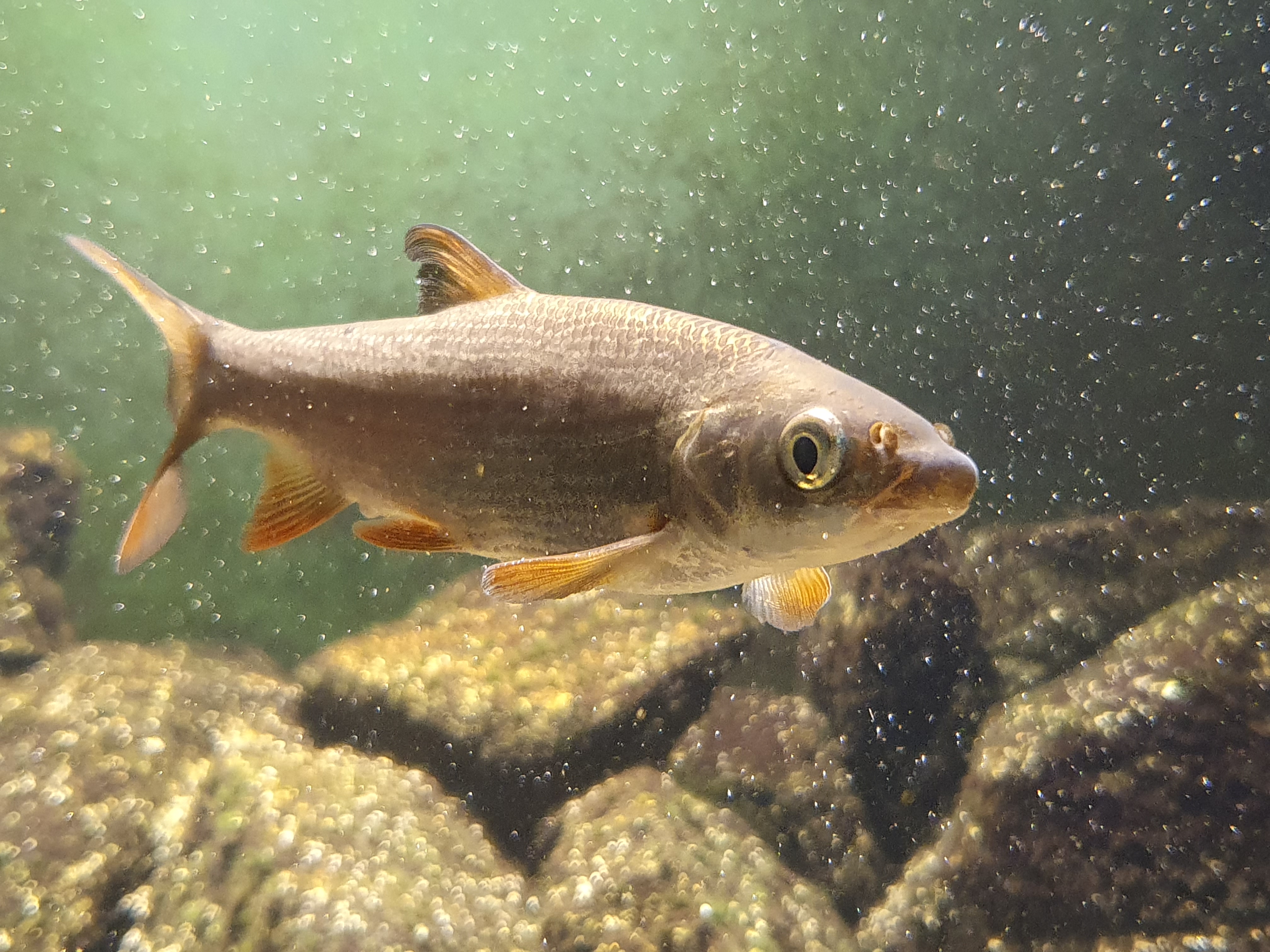
common nase, © Robert Togel (Images courtesy of viadonau)
This project fulfils version 1.1 of the quality criteria for citizen science projects on Österreich forscht.
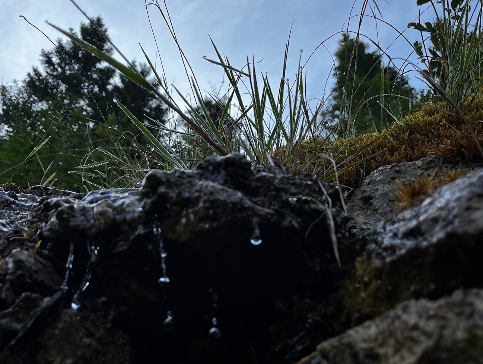
On the trail of springs
Spring habitats in the Großes Walsertal Biosphere Reserve
In view of increasing extreme weather events, including periods of drought and consequent water shortages, the protection and knowledge of springs in the Großes Walsertal Biosphere Reserve is becoming increasingly important. In addition to their essential role in water supply, springs are often small but very important habitats for endangered organisms. The pressure to utilise and develop existing springs has increased significantly due to climate change. In order to raise awareness of these special habitats and obtain an overview of the existing spring habitats in the valley, the KLAR! Biosphärenpark Großes Walsertal is launching a citizen science project in cooperation with Life Science AG.
As an introduction, an online workshop will take place on 18 February 2025 from 19:00 to 20:30. Participants will gain exciting insights into the hidden world of springs, their ecological value for highly specialised species and the importance of certain organisms as indicators of water quality. They will also be shown how climate change and increasing utilisation pressure are affecting these sensitive habitats. Finally, the methodology of spring mapping will be presented and a typical mapping day outlined. After the workshop, interested parties will have the opportunity to secure a place on the field trip in summer 2025, during which the methodology will be applied in the field.
Life Science AG has already successfully carried out a citizen science project to record spring habitats in the Black Forest biosphere area and will now transfer this project to the conditions in the Großes Walsertal. The tried-and-tested mapping and evaluation method records not only the location but also characteristics such as spring size, temperature, cultural-historical significance, flora and fauna as well as potential human influences. As an alternative to the tried-and-tested analogue recording, the Qfield app is also being adapted so that walks in the Großes Walsertal can become small research trips.
As a model region for sustainable development, the biosphere reserve bears a special responsibility for the long-term protection of natural springs. We are committed to securing the supply of drinking water and at the same time protecting the habitat for rare species. At the same time, we must ensure that the springs are utilised in the most environmentally friendly way possible to provide water for humans and animals.
If you are interested, please register in advance with our Klar! manager - Lukas Ellensohn at This email address is being protected from spambots. You need JavaScript enabled to view it.. He will send you all further details and the link to the online workshop.
This project fulfils version 1.1 of the quality criteria for citizen science projects on Österreich forscht.
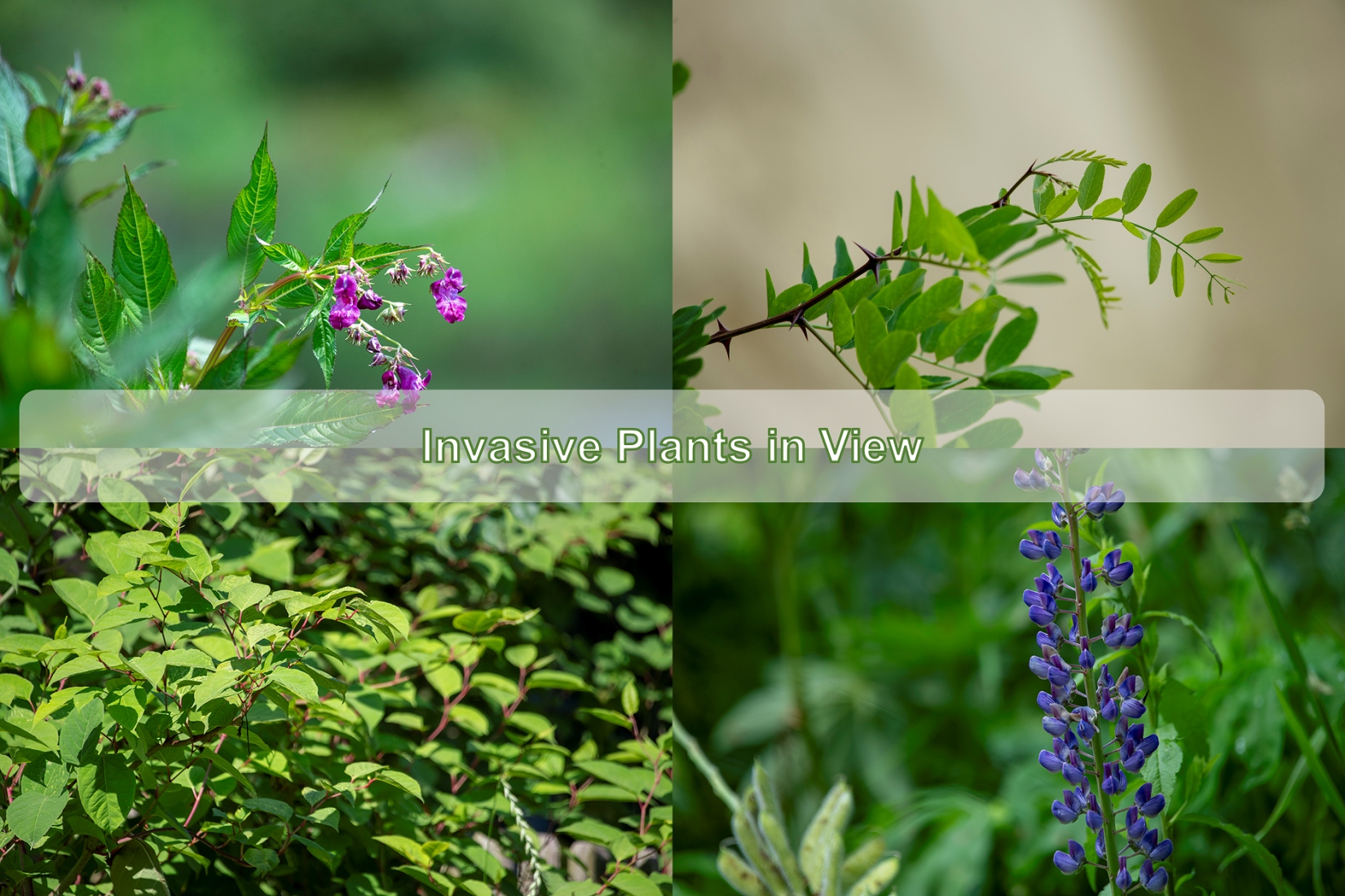
Invasive Plants in View
Monitoring in the Karawanken UNESCO Global Geopark
Together we can limit the spread of invasive species and protect the biodiversity of our mountain regions!
Project description
Our Citizen Science project is dedicated to the spread of Invasive Alien Species (IAS) in the Geopark Karawanken. Invasive species are plants or animals that are mostly introduced by human activity into regions where they do not originally occur, for example through intercontinental trade. While most introduced species are dependent on human support to survive, there is a minority that can adapt to the new environment and survive independently. Some of these species develop large populations very quickly and pose a significant threat to native ecosystems.
You can find a brief overview of our project in this video:
The problem
Invasive alien plants can spread rapidly because they produce large quantities of seeds, grow quickly and have few natural enemies in their new environment. This enables them to colonize new areas quickly and displace native species. They can also pose a direct threat to humans, for example through negative impacts on infrastructure or human health.
Mountain regions are currently less affected by invasive plants, but the risk is increasing due to climate change and human land use. The species are often introduced at lower altitudes and spread along corridors such as roads, hiking trails and watercourses to higher altitudes. Seeds and spores can stick to tires, shoes and tools (such as tractors) and spread in this way. Intentionally introduced material, such as for road construction, or planting material, such as seed mixtures for roadsides or ski slopes, also contribute to their spread.
With our project, the Geopark Karawanken aims to create a basis for planning targeted measures to limit the spread of invasive plants.
Examples of invasive plants and their characteristics:
- Canadian goldenrod (Solidago canadensis) CC-BY 2.0 Andreas Rockenstein (https://creativecommons.org/licenses/by/2.0/at/) Canadian goldenrod (Solidago canadensis) CC-BY 2.0 Andreas Rockenstein (https://creativecommons.org/licenses/by/2.0/at/)
- Giant hogweed (Heracleum mantegazzianum) CC BY-SA 4.0 Dietmar Rabich (https://creativecommons.org/licenses/by-sa/4.0) Giant hogweed (Heracleum mantegazzianum) CC BY-SA 4.0 Dietmar Rabich (https://creativecommons.org/licenses/by-sa/4.0)
- Himalayan balsam (Impatiens glandulifera) © Urosh Grabner Himalayan balsam (Impatiens glandulifera) © Urosh Grabner
- Japanese knotweed (Fallopia japonica) © Urosh Grabner Japanese knotweed (Fallopia japonica) © Urosh Grabner


https://www.citizen-science.at/en/about/about-oesterreich-forscht/tag/plants#sigProId75c9df7eb2
What can I do to support the project?
You can share locations of invasive plants with us via the iNaturalist platform and thus make a valuable contribution to protecting the native flora and fauna in the Karawanken Geopark area.
To help you get started, here is a step-by-step guide for Citizen Scientists:
Part I: What is iNaturalist and how can I use the platform (GER)
For Geopark schools and hiking guides:
Raise awareness of invasive plants in the Karawanken-Karavanke UNESCO Global Geopark and support us in documenting affected sites: During a hike or as part of a school excursion, you can document invasive plants in iNaturalist together with your group and educate participants about their problems and impacts on native ecosystems.
You can of course use all available documents (short video and step-by-step instructions) for your activity. If you need further support for the implementation, please contact us (This email address is being protected from spambots. You need JavaScript enabled to view it.).
Do you want to take action and stop the spread of invasive plant species?
If you want to do more, you can help us control the spread of plants:
Remove neophytes in your neighborhood
If you live nearby, you can clear an area in your neighborhood of neophytes in consultation with the landowner. There are different methods of removal depending on the plant in question. Balsam, for example, can be easily pulled out along with its roots. Remove the plants BEFORE the seeds ripen on a dry day. Canadian goldenrod can be pulled out by hand or with a spade when the soil is moist. Large populations can be reduced by regular mowing BEFORE the flowering period. Plant parts can be composted on site, roots, flowers or seeds can be transported away in bags and disposed of in residual waste to prevent the plant from spreading further.
Instructions for the removal of various invasive plants can be found in the practical guide Neophytes from the Swiss Agency for Environment & Communication.
Organize your own joint action to remove neophytes in the Karawanken Geopark
You can also organize a joint action to control the spread of neophytes in the Geopark - for example with your school class or as a hiking group. Clarify the action with the landowner of the area beforehand. The Geopark Karawanken team will support you with the planning.
We would be delighted if you kept us informed about your activities at This email address is being protected from spambots. You need JavaScript enabled to view it.
Thank you for your support and your valuable contribution!
ATTENTION Giant hogweed!!!
What should I do if I discover the giant hogweed in the Karawanken Geopark?
- Keep enough distance from the plant.
- Avoid skin contact and wash the affected areas immediately.
- Document the plant and its location (on iNaturalist).
- Inform other hikers and mark the location.
- Notify the municipality and/or the Geopark Karawanken team (This email address is being protected from spambots. You need JavaScript enabled to view it.)
- Monitor your skin for reactions and seek medical help if necessary.
- Please DO NOT remove the giant hogweed yourself without protective equipment!!!
Further details to the project
Project Area
The Karawanken UNESCO Global Geopark covers an area of 1,067 km² and includes five Slovenian and nine Austrian municipalities. This cross-border area is a unique natural and cultural experience region characterized by its outstanding geological heritage. The aim of the Geopark is to preserve the geological and natural resources as well as the cultural heritage of its members. By raising awareness, providing information, and education about the Geopark and its network at European and global levels, it contributes to strengthening its position as an important geopark. The Geopark also promotes economic use through sustainable tourism and supports cross-border cooperation for the sustainable development of the region.
Further information about the Karawanken Geopark can be found on the Geopark homepage and our social media channels (@visitgeoparkkarawanken).
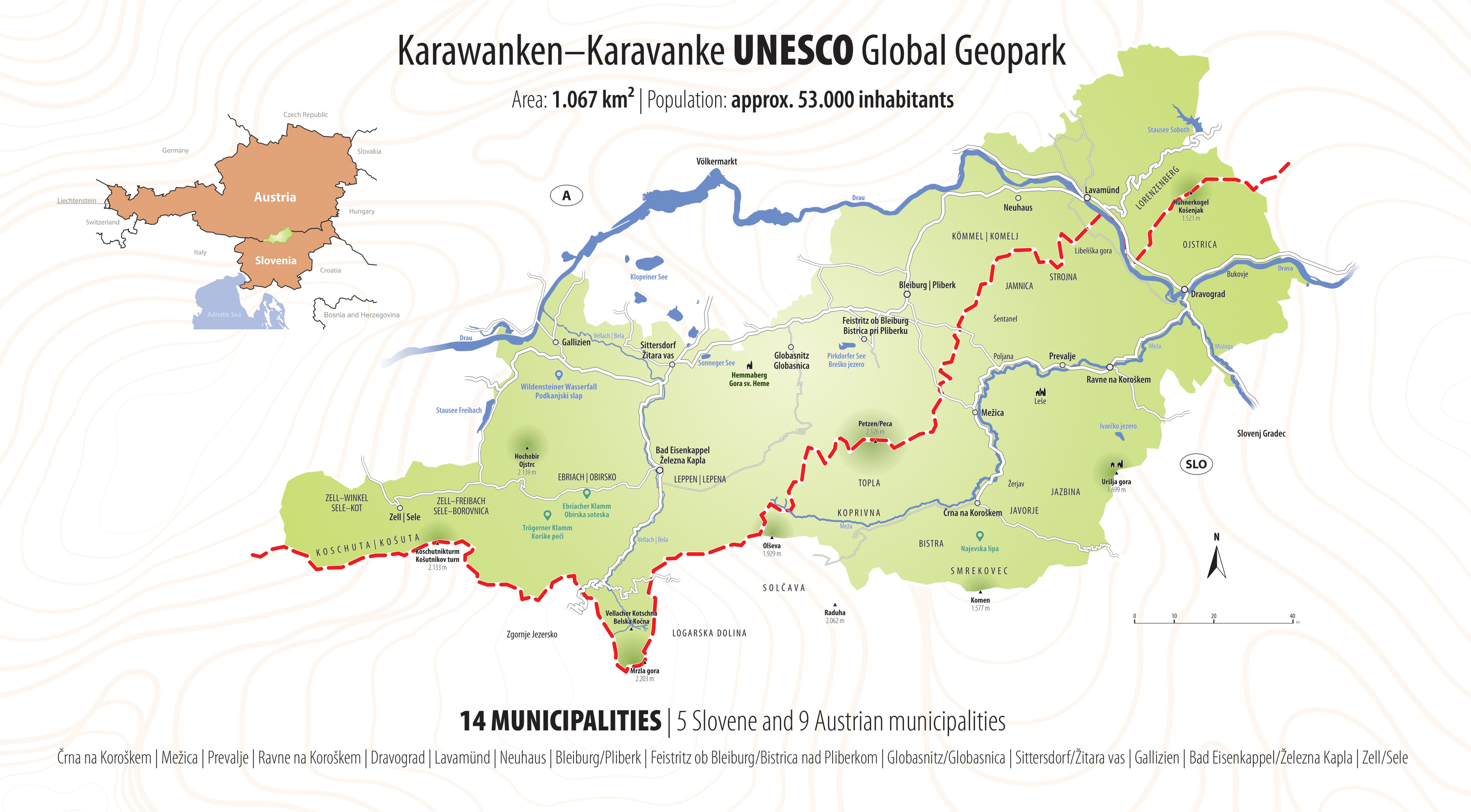
Image 3: Overview map Karawanken UNESCO Global Geopark © Urosh Grabner
Project Goals
- Monitoring and Early Detection: Establishing a network to monitor invasive species in the Karawanken UNESCO Global Geopark in order to detect their spread at an early stage.
- Awareness-Raising and Education: Informing and involving the population about the importance and impact of invasive alien species and the influence of climate change and human activities on their spread.
- Data Collection and Analysis: Collecting and analyzing data on the occurrence and spread of invasive species by citizen scientists.
- Management and Control: Developing an action plan to control and contain invasive species in order to protect native ecosystems.
Methodology
- Participation: Involving the population as citizen scientists who collect data on the occurrence and spread of invasive species.
- Training and Workshops: Providing online educational materials and workshops to equip participants with the necessary knowledge and skills to identify and report invasive species.
- Online Green Academy
- Workshops
- Data Platform: Using the iNaturalist platform to record the locations of plant species. The collected data is validated there and then analyzed and published by the Carinthia University of Applied Sciences (UNESCO Chair for Sustainable Management of Protected Areas).
Expected Results:
- Improved Data Basis: Basic data collection on the occurrence and spread of invasive species in the Karawanken Geopark.
- Increased Awareness: Better-informed and engaged population actively contributing to monitoring and protecting native ecosystems.
- Effective Management Strategies: Action plan to control and contain invasive species in hard-to-reach areas.
Data Protection Information
No participant data is analyzed in this project. By joining, participants agree to iNaturalist's terms of use. Users control what data is visible to others when creating iNaturalist data, and settings can be managed in account details on the platform.
Project Details and Contact
This project is co-funded by the INTERREG Central Europe project HUMANITA - Human-Nature Interactions and Impacts of Tourism Activities on Protected Areas, supported by the Interreg CENTRAL EUROPE Program 2021-2027 with co-financing from the European Regional Development Fund (ERDF). The project's total budget is EUR 2,396,346.70, with EUR 1,917,077.36 funded by ERDF.
If you have any questions or require further information, please do not hesitate to contact us:
FH Kärnten: Lilia Schmalzl (This email address is being protected from spambots. You need JavaScript enabled to view it.)
Karawanken UNESCO Global Geopark: Urosh Grabner (This email address is being protected from spambots. You need JavaScript enabled to view it.)
This project fulfils version 1.1 of the quality criteria for citizen science projects on Österreich forscht.
City-Zen Boden
“Healthy Soil" research platform for Viennese community gardens
As a follow-up project to "Heavy Metal City-Zen", we are once again inviting Viennese community gardens, garden projects or similar garden initiatives to take part in this project and conduct research together with us.
The aim of this project is to scientifically assess the potential risk of heavy metal contamination of crops in Viennese city gardens and to investigate the extent of soil contamination with microplastics.
We will make the results of the study and additional information on soil health available on our City-Zen soil research platform, which we are developing as part of the project.
Background
Urban gardening has become increasingly popular over the last two decades. However, gardeners are often concerned about their crops being contaminated by pollutants such as heavy metals.
Plant availability of heavy metals is strongly influenced by the soil properties and the plants being cultivated. Through appropriate soil management, it is possible to reduce the potential transfer of heavy metals to plants.
We want to test whether the heavy metal content in plants grown in one variant (e.g. a mix with compost) differs from those plants grown in a control variant (untreated urban soil).
How do we want to test this?
We need you for this! Become a Citizen Scientist by conducting a "pot experiment" with radishes in your urban garden. Plant and soil samples will be collected from these tests and an analysis for heavy metals will then be carried out in our laboratory.
Participation in the project will benefit the entire community of the garden. Together we can generate the following information about the garden's location:
- Whether and to what extent the soil in your garden is contaminated with heavy metals and microplastics.
- If contamination is present, whether the soil treatment you have chosen could reduce the transfer of these heavy metals to the plants.
- We can also do on site measurements of soil and plant parameters such as pH and yield.
Further information on the project can be found on the website.
Who can take part in the "City-Zen Soil" project?
- People who are involved in a community garden, garden project or similar garden initiative.
- These gardens are in Vienna.
What do I have to do to take part in the project?
Simply write to us by e-mail if you are interested in taking part: This email address is being protected from spambots. You need JavaScript enabled to view it.
The project is funded by the Vienna Business Agency. A fund of the city of Vienna.

The results of the "Heavy Metal City Zen" project can be found in our blogpost (in German) and on our project website.
This project fulfils version 1.1 of the quality criteria for citizen science projects on Österreich forscht.